 NERC Data Catalogue Service
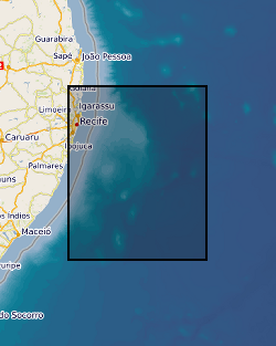
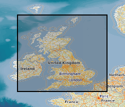
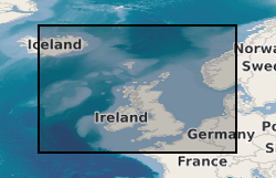
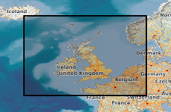
Marine surveys
Type of resources
Topics
Keywords
Contact for the resource
Provided by
Years
Formats
Representation types
Update frequencies
Scale
-
The dataset consists of: (1) Listing of full site survey package of geophysical data held in the IODP Data Bank in support of proposal 864. Details of how to obtain existing freely available or commercial proprietary data are included. (2) Final version of Full Science Proposal 864, which contains: description and illustrations of the regional stratigraphy of Pernambuco Plateau, as interpreted by the Virtual Site Survey project; site summary sheets for all proposed drill sites based on the Virtual Site Survey. (3) A complete list of all deliverables associated with this project is provided in the Data Archiving Report.
-
This document data set contains paper copies of selected geophysical borehole logs made from the master data set held by the BGS National Geological Records Centre (NGRC) at Keyworth. These have been made for interpretation. Most data are within the UK onshore area; although there are some UK near-shore and offshore (North Sea, Irish Sea) and foreign data. Most data were acquired for commercial hydrocarbon exploration and subsequently provided to BGS for use on specific projects. Some data were acquired by BGS and other public-sector bodies for research purposes (e.g. geothermal energy). The documents are dyeline prints or plain-paper photocopies. They are stored folded in boxes, approx 20 logs per box, approx 500 boxes. There are some duplicates. Only a sub-set of the available borehole logs have been copied, usually for deep boreholes or boreholes of special significance in the interpretation of seismic data. Mostly concentrated in areas prospective for coal, oil and gas.
-
The British Geological Survey hold a collection of data recorded during marine geophysical surveys which includes digital data and analogue records. These data result from approximately 350,000 line kilometres of multi-instrument geophysical survey lines. The data include seismic, sonar, magnetic, gravity, echo sounder, multibeam bathymetry and navigation data. The seismic data are mainly for airgun, sparker, boomer and pinger. The data were primarily collected by BGS and the collection also includes additional third party data. The data are primarily from the UKCS (United Kingdom Continental Shelf). The data are stored within the National Geoscience Data Centre (NGDC) and the Marine Environmental Data and Information Network (MEDIN) Data Archive Centre (DAC) for Geology and Geophysics. The majority of legacy geophysical paper records are available as scanned images viewable via the BGS Offshore GeoIndex www.bgs.ac.uk/GeoIndex/offshore.htm. Other records can be scanned on request. Older records are of variable quality. Data not yet available online including segy are available on request enquiries@bgs.ac.uk. The data are applicable to a wide range of uses including environmental, geotechnical, geophysical and geological studies. Reference: Fannin, NGT. (1989) Offshore Investigations 1966-87. British Geological Survey Technical Report WB/89/2, British Geological Survey.
-

The data set consists of the results of particle size analysis (PSA) performed on approximetaly 29,000 sea-bed sediment samples collected by BGS from the UK Continental Shelf and adjacent deep water areas, mostly using sediment grabs, but also sediment corers on occasions. Measurements were also made on approximately 8000 downhole sub-samples from shallow cores and boreholes. Data from other UK organisations have also been added to the PSA dataset. The data are stored as part of the National Geoscience Data Centre (NGDC) and the Marine Environmental Data and Information Network (MEDIN) Data Archive Centre (DAC) for Geology and Geophysics. Data are delivered via the BGS Offshore GeoIndex www.bgs.ac.uk/GeoIndex/offshore.htm Seabed Sediment Data layers.
-
Corrected and smoothed and network adjusted ship gravity, magnetics and bathymetry data acquired by BGS as part of its Offshore Reconnaissance Mapping Programme. This programme was commenced in 1967, funded mainly by the Department of Energy.
-

The Marine Maps and Chart Archive held by BGS contains maps created by BGS (the majority of which result from BGS offshore mapping projects) and also maps acquired from various other sources (e.g. UK Hydrographic Office and MCA Civil Hydrography Programme survey charts). The maps which date from the 1960s onwards are very variable in subject type and scale ranging from survey navigation to geological interpretation. The maps are primarily for the UKCS (United Kingdom Continental Shelf). The coverage of some map types is the entire UKCS whilst other have only regional or localised extent. The maps which are a mix of paper and digital are applicable to a wide range of uses including environmental, geotechnical, geophysical and geological studies. range of uses including environmental, geotechnical, geophysical and geological studies. Scanned maps can be viewed via the BGS maps portal http://www.bgs.ac.uk/data/maps.
-
The Marine Reports Archive held by BGS includes published and unpublished reports created by BGS and acquired from various sources. The reports which date from the 1960s onwards include the BGS Marine Reports Series, Marine Commercial reports and associated records, Palaeontology reports and other specialist reports. Examples of report types are data acquisition and processing reports, site investigation reports and interpretation reports. The reports are primarily for the UKCS (United Kingdom Continental Shelf). The coverage of some reports is the entire UKCS whilst other have only regional or very localised extent. The reports are applicable to a wide range of uses including environmental, geotechnical, geophysical and geological studies.
-
The concentrations of up to 30 trace elements in approximately 9,000 sea-bed samples from the UK Continental Shelf were determined by BGS using a variety of analytical techniques. In some cases samples were tested using more than one method. The analyses were carried out on freeze-dried samples of the sand and mud fractions of the samples. The data are stored as part of the National Geoscience Data Centre (NGDC) and the Marine Environmental Data and Information Network (MEDIN) Data Archive Centre (DAC) for Geology and Geophysics. Data are delivered via the BGS Offshore GeoIndex www.bgs.ac.uk/GeoIndex/offshore.htm geochemical layers. References: Stevenson, A G (2001) Metal concentrations in marine sediments around Scotland: a baseline for environmental studies, Elsevier Science; Stevenson, A G et al (1995) The geochemistry of sea-bed sediments of the United Kingdom Continental Shelf : the North Sea, Hebrides and West Shetland shelves, and the Malin-Hebrides sea area (http://nora.nerc.ac.uk/507899/).
-
The data consist of the results of geotechnical testing carried out at various depth intervals on shallow cores or boreholes collected BGS from the UK Continental Shelf. The bulk of the data north of 56N are in digital form and result from testing carried out on board survey vessels using hand-held test equipment (penetrometers and shear vanes). These values are averaged for each test interval, and are expressed in kiloPascals. There are approximately 6000 test results in the data set. Some more detailed test information, in non-digital and report form is held for selected sites. Also for most sites where digital data is not available, geological descriptions of core material will also contains semi-quantitative information on the stiffness of the material. Geotechnical knowledge is required to understand and interpret the results if they are to be used as a basis for engineering studies. Core material are managed as part of the BGS Materials collection and are available for examination, testing or subsampling. The data are stored as part of the National Geoscience Data Centre (NGDC) and the Marine Environmental Data and Information Network (MEDIN) Data Archive Centre (DAC) for Geology and Geophysics. Data are delivered via BGS Offshore GeoIndex www.bgs.ac.uk/GeoIndex/offshore.htm geotechnical layers. Reference: Fannin, NGT. (1989) Offshore Investigations 1966-87. British Geological Survey Technical Report WB/89/2, British Geological Survey.
-
The Marine Photographs Archive held by BGS includes photographs of hydrocarbon well and (non-hydrocarbon) marine boreholes, cores and other samples. There are also photographs of the seabed and survey operations. The photos are primarily for the UKCS (United Kingdom Continental Shelf) and surrounding areas and date from the 1970s onwards. The photographs, which are a mix of prints, negatives and digital are applicable to a wide range of uses including environmental, geotechnical and geological studies. There are also some x-rays of cores.